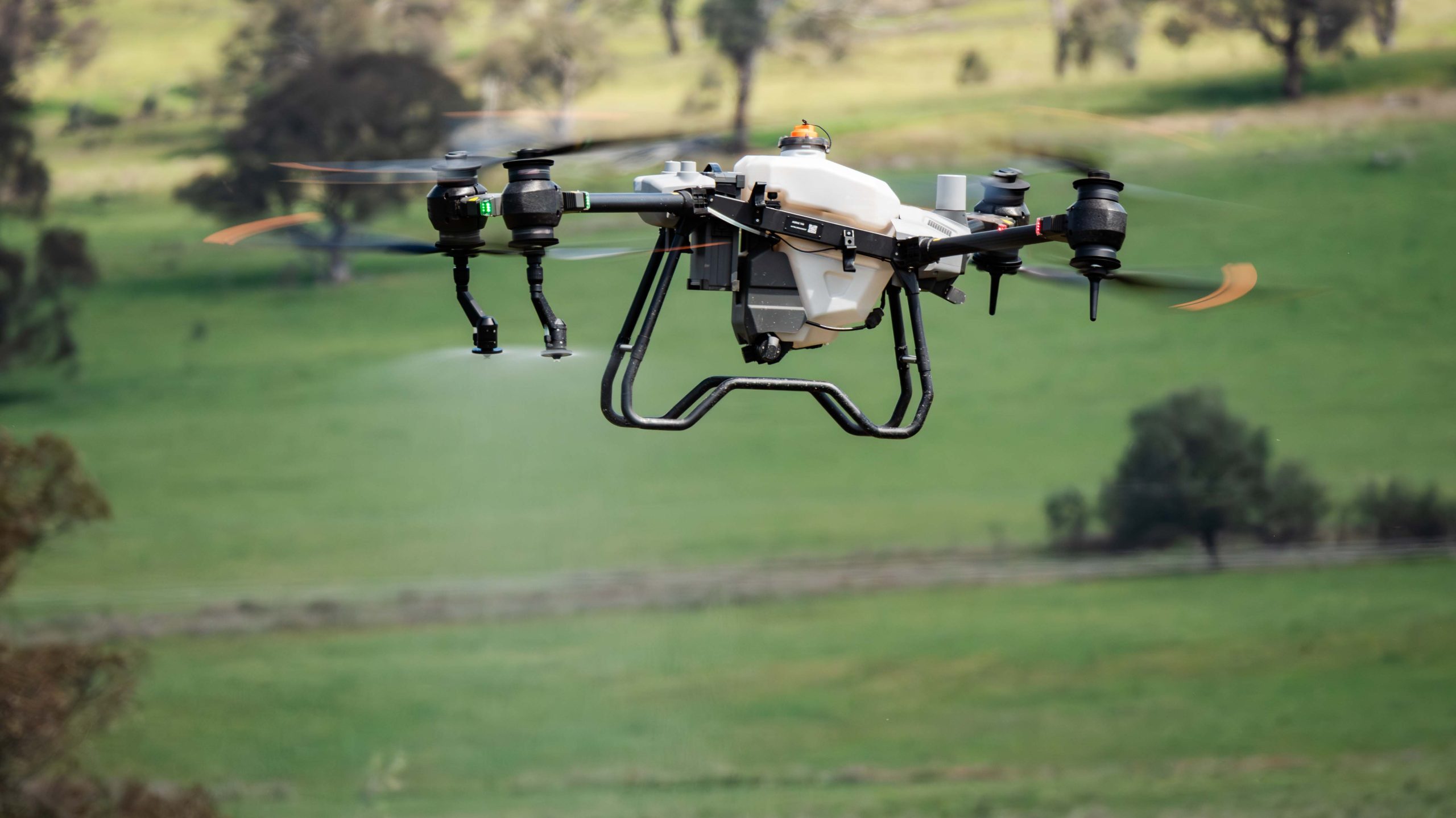
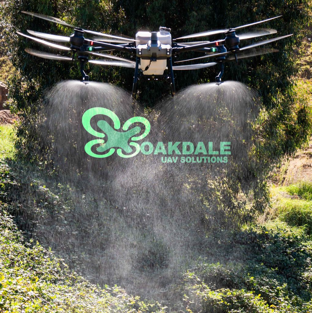
Aerial spraying has never been easier since the introduction of Spraying drones and my DJI T40 is no exception!
With it’s advances in technology I’m able to provide you with a wide range of options in regards to aerial application, which will altimately save on time, money and labour.
But! First for me to achieve this I need to ask the right questions to provide you with the best solution.
Got a small job in mind?
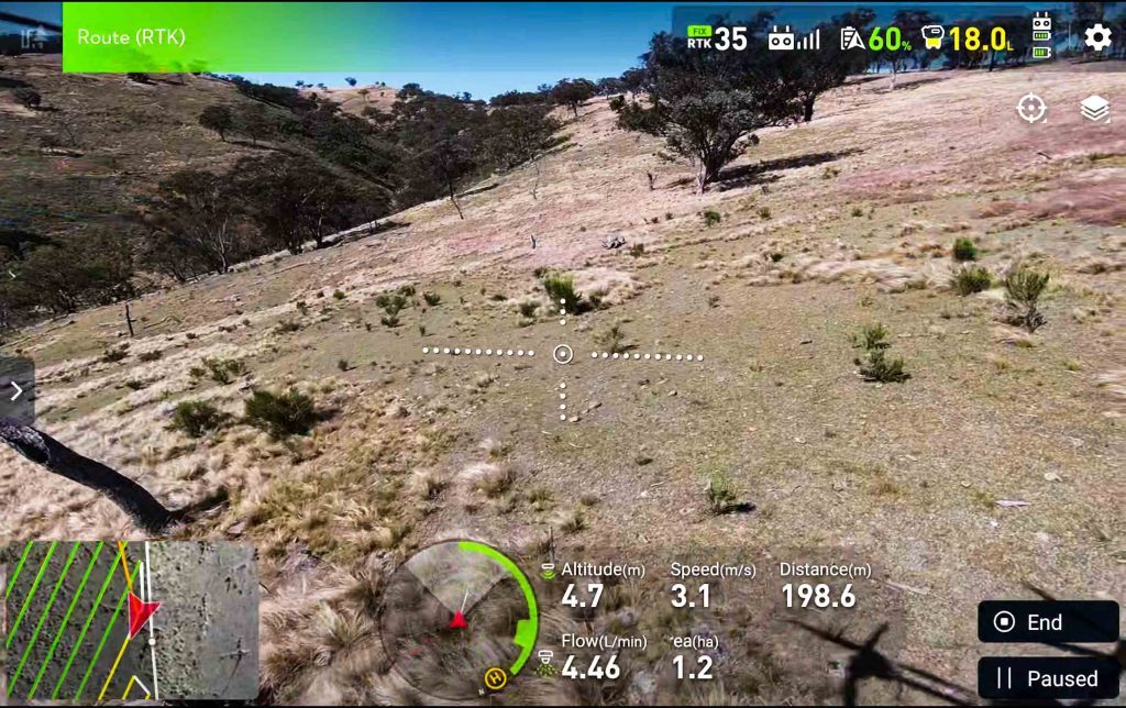
For smaller jobs that are pretty straight forward I use the built-in flight modes. The type of job that has minimal obstacles and is easily viewed from a distance.
I use a combination of visual elements such as Ground effects from propwash and viewing the FPV Monitor whilst utilizing the spray drones Semi automatic functions.
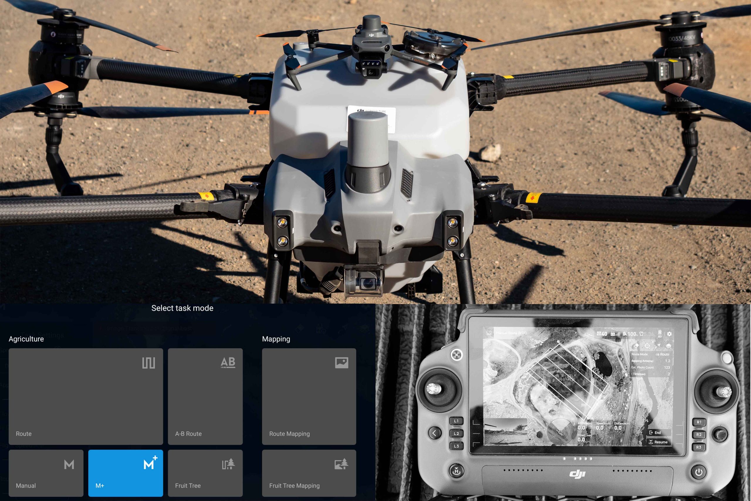
“Manual Plus” is one of my favourite built-in modes especially for spot treating smaller infestations of Blackberry!
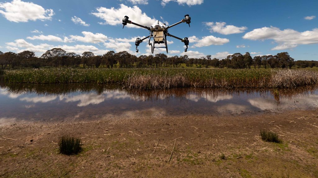
“A-B Route” came in handy for treating Cattail grass in the middle of a dam!
Large! Complex! Trees! ohh my!
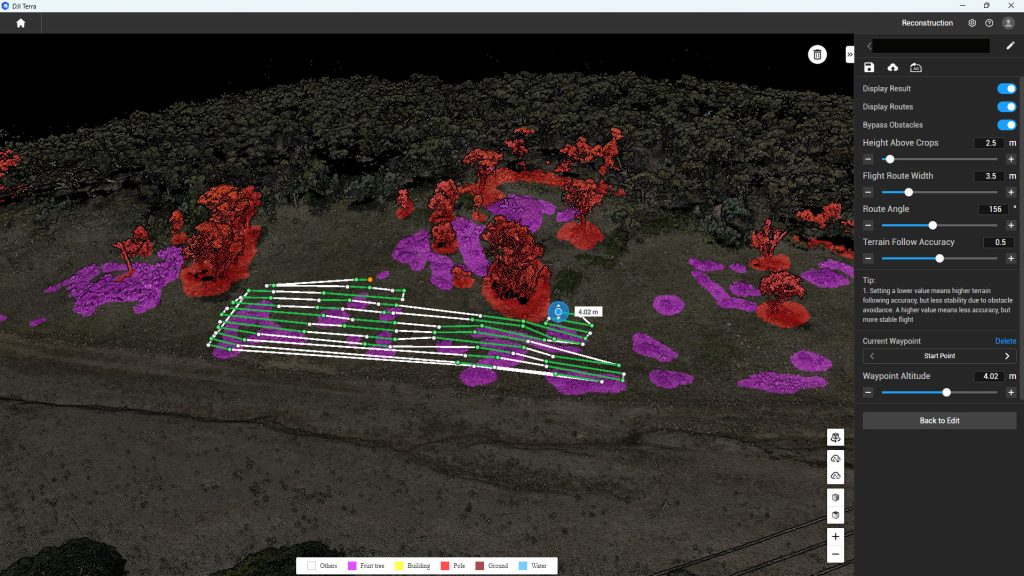
For large or complex spray jobs I use my DJI Mavic 3 Multispectral drone to map the site.
This provides me with so much information to create safe and efficient flight paths for my T40 to follow.
Mapping for flight planning speeds up the application process by pre-recording obstacles and terrain,
creating a fully autonomous operation, once uploaded onto the Spray drones Remote controller.
It also results in less product wastage as it is only applied where required in a controlled amount!
Drone spraying operations such as Variable Rate and Weed mapping are also achievable through this application workflow!
For more infomation on my workflow , checkout my Drone mapping page
Everyday someone discovers a new use for a Spray drone! and in Australia the capabilities are literally endless!
Things like Herbicides, Liquid Fertilizers, Insecticides Fungicides are some of the common applications.
So, Whether it’s spraying weeds in tough places, a broad acre situation, or even Greenhouse treatments, Im sure I have a solution for you.
So, where do we start?
I usually start by asking, what’s the area size? the terrain? Location? some satelite images off “Six Maps” or “Google” of the treatment area. Mobile phone shots of the current situation. Some sites are too difficult to build a mental picture of and may require a “Site visit” (Don’t worry it’s free)
All this info allows me to understand the scope of the project, and to determine what is the best way to attack it!
For more infomation on our spraying ops checkout our blogs