Drones are perfect for mapping because they can cover a considerable area in a short time and capture high resolution imagery. With the implementation of RTK and Terrain follow mapping drones are more powerful then ever!
At Oakdale I use Drone mapping for Flight Planning, Crop health monitoring and Variable Rate Applications.
Mapping and Aerial applications
By utilizing the mapping data collected from my Mavic 3 Multispectral (M3M) drone, I am able to perform accurate flight planning for my Aerial Application services.
DJI's Terra
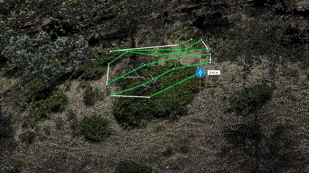
Using “Terra” software, I accurately locate things like weed clusters, Boundaries, Obstacles, Treatment areas and No Spray zones.
Fully automated 3 dimentional flight routes are than created for my DJI T40 agricultural drone to use when applying product.
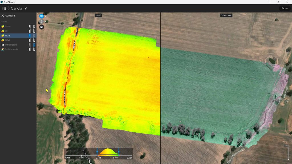
Mapping and Crop Health
The M3M’s Multispectral sensors allow for many customizable plant indexes, which are essential for Crop health monitoring
My M3M has four Multispectral bands including, Near Infra-Red (NIR), Red Edge, Red and Green.
Mapping and Variable Rate Application (VRA)
VRA is also made possible with the M3M because it uses standard plant indexes such as NDVI and NDRE
We also do Variable Rate Appliction (VBR) by drone! click the button
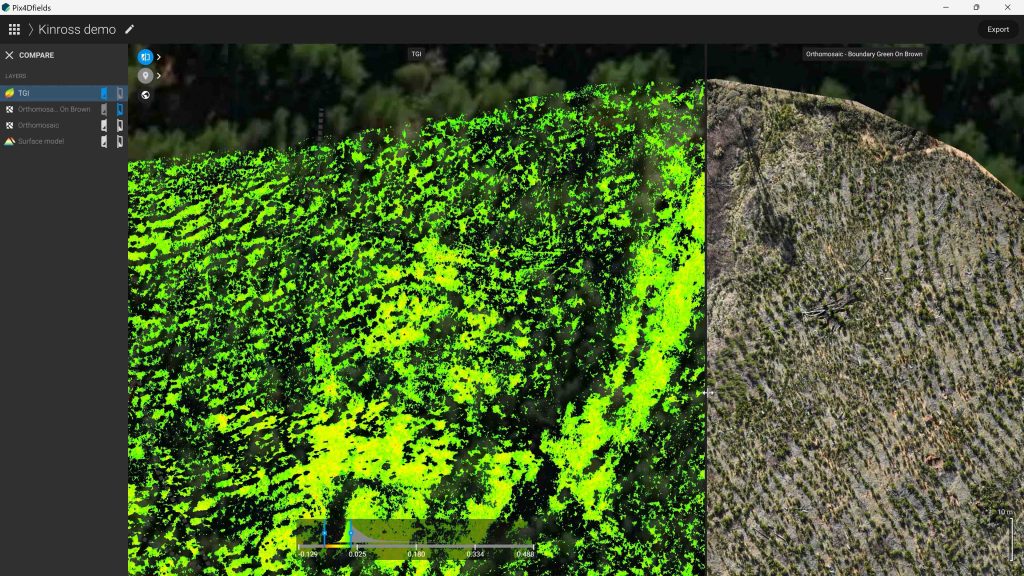
Weed mapping is a great way to spot treat weeds in Crops, Fallow and Pasture to have minimal effect on desired plant species. Also to help reduce costs and lower chemical resistance.
With Pix4D Fields I acheive this by using special index layers for “Green on Brown” weed mapping .
Or by using the”Magic Tool” to single them out. Both options require high resolution RGB imagery which can be easily captured using the M3M drone.